
2.1. Definition of social and territorial boundaries
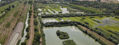
Defining the boundaries of the focal area is an essential initial step in analysing the WEFe nexus and identifying potential solutions. This process involves determining the limits within which the study will be conducted (i.e., specifying who and what will be included, and who and what will be excluded from the study). The establishment of clear boundaries is therefore critical to clarify the scope and scale of the analysis, ensuring that the study remains focused and manageable.
 Definitions defining boundaries
In the WEFe Framework 2.0, the focal area is the main area under assessment where a solution approach to WEFe nexus issues will be identified and implemented. The focal area is delimited by the social and/or territorial boundaries identified in this task and thus the outcome of this task. It can be a watershed, a specific landscape, an administrative region, or a farming community.
How to define boundaries in the WEFe Framework 2.0?
The WEFe Framework 2.0 applies to a specific geographic area, starting with the identification of a problem in that region. The boundaries are defined using guiding questions, without requiring data collection at this stage. The decision is made by the analyst or decision-maker based on their prior knowledge of the problem and the local context.
Guiding questions for reflecting system boundaries: What is in, and what is out?
Download FREE guide
Expected output
The outcome of this first step is a brief description of the boundaries of the focal area where the WEFe Framework 2.0 will be applied to improve WEFe nexus issues. It should include a map highlighting the boundaries and explain the relationship of this area with other administrative or biophysical boundaries, such as watersheds or habitats.
Quick links
At first, the focal area boundaries are set, but they may change as the WEFe nexus problem becomes clearer.